LANDSLIDE MONITORING
LANDSLIDE MONITORING WITH INDUSTRIAL DEVICES AND ARTIFICIAL INTELLIGENCE
UNINTERRUPTED MONITORING
Our unique platform allows you to keep an eye on landslides at all times. Thanks to advanced automation, follow the evolution of the project in real time, 24 hours a day.
REMOTE MANAGEMENT
Manage the settings of your timelapse shooting from anywhere, at any time, thanks to remote control.
DURABILITY TESTED
Avacam devices and services are built to be resistant, even in extreme weather conditions, minimising the need for on-site interventions.
SIMPLE SETUP
Avacam’s time lapse systems for remote landslide monitoring are ready to use, with configurations that can be optimised and adjusted remotely.
WEATHER RESISTANCE
Our time lapse recording devices are designed to perform perfeclty in all weather conditions and at any extreme temperature.
ALERTS FOR MALFUNCTIONS
Immediate information is sent to the person identificated about any problem or system malfunction with fast and accurate alerts.
PROTECTION OF PERSONAL DATA
Our state-of-the-art software ensures that every shot is processed to ensure anonymity, masking sensitive data such as faces and other details to fully comply with privacy regulations.
SUPERIOR QUALITY
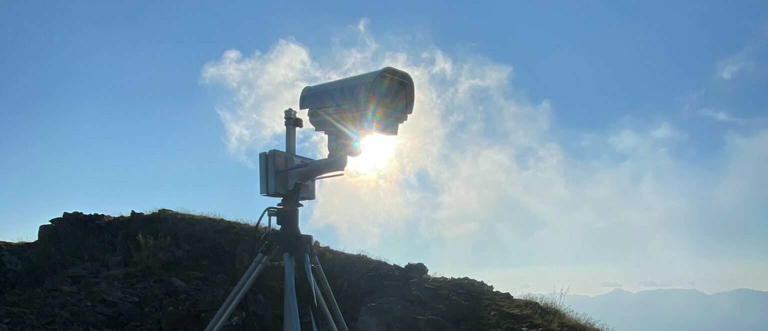
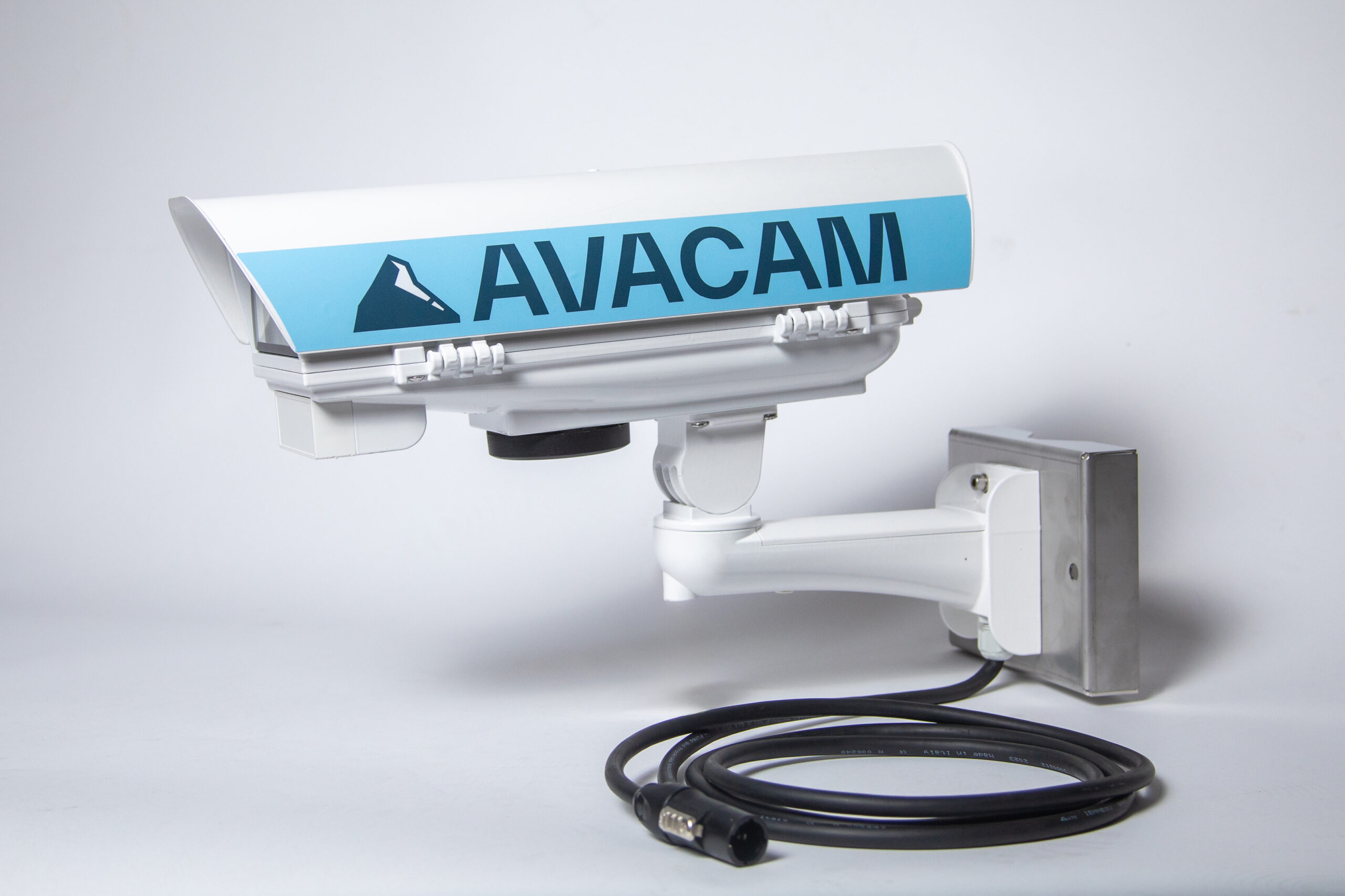
Avacam time lapse devices are built with premium materials and equipped with interchangeable lenses that guarantee exceptional quality footage.
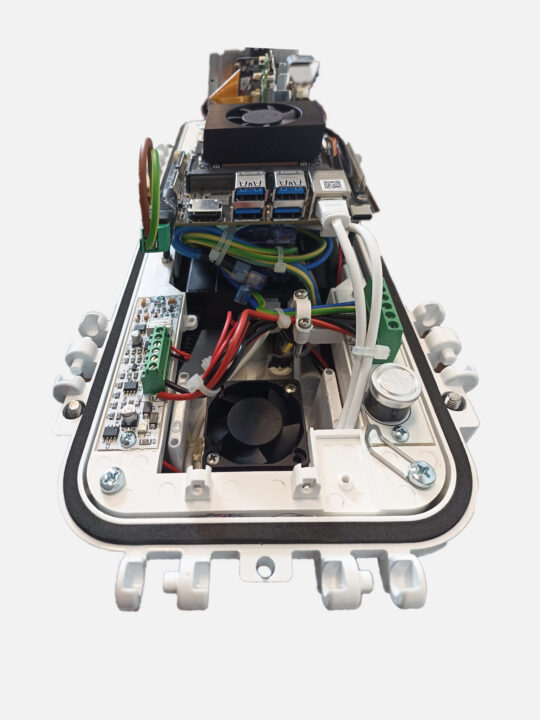
In-House Design & Custom Hardware Manufacturing
100% proprietary technology, built specifically for your monitoring needs.
Unlike standard system integrators, at Avacam we don’t just assemble third-party components.
We engineer, design, and manufacture our devices in-house.
This allows us to build custom hardware tailored to any geological scenario, ensuring total control over data quality and seamless integration with our proprietary software.
Advanced Technologies
HIGH-TECH Landslide monitoring with custom-made devices and proprietary software
Avacam is an innovative real-time landslide photo-monitoring service that uses a high-efficiency device based on artificial intelligence. This service differs from competitors because it allows you to take timelapse photos, providing an effective and precise method to monitor by remote ground movements, with a view to analysing and forecasting geologically unstable areas.
Thanks to its advanced technology and its ease of installation and maintenance, Avacam is a plug and play product capable of withstanding even the most extreme weather conditions. All the images acquired by our landslide monitoring tools are stored on a central server, allowing the creation of time-lapses of the highest quality, also by remote. This makes it possible to highlight even the slowest landslide movements, providing a valuable tool for the prevention and management of landslide risk.
We provide a personalised consulting service to offer you the solution that best aligns with your needs, with customised reports and alerts.
Find out more about our services and feel free to contact us: [email protected]
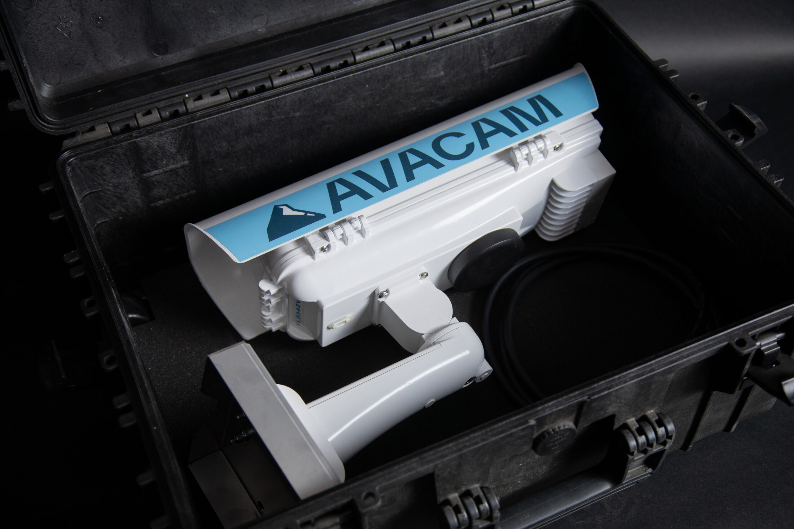
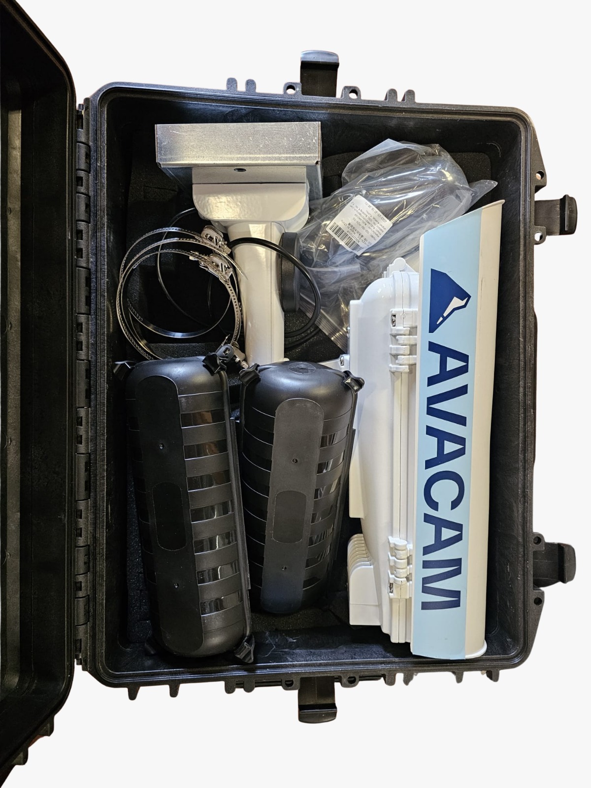
OUR DEVICES
DISCOVER OUR INDUSTRIAL DEVICES

Frequently Asked Question
1. Does Avacam work in areas without electricity or wired internet?
Absolutely. Our systems are specifically designed for landslide monitoring in remote or "off-grid" areas. The devices are powered by high-efficiency solar panels and transmit data using 4G/LTE/LTE-M connectivity. This ensures continuous operation even in high-mountain regions or isolated construction sites without existing infrastructure.
2. What is the difference between Avacam and a regular CCTV camera?
Unlike CCTV cameras that compress video for security, Avacam is a technical monitoring tool for landslide monitoring. We capture ultra-high-resolution still images (up to 4K and beyond) at regular intervals. This allows for detailed analysis, creating precise time-lapse historical records, and providing clean visual data essential for geological and structural analysis—something that compressed video frames cannot achieve.
3. Are Avacam devices resistant to extreme weather conditions?
Yes, Avacam hardware is certified to operate in harsh environments. The enclosures are rated IP67/IP68 (waterproof and dustproof) and are tested to withstand temperatures ranging from -20°C to +50°C, heavy snow, torrential rain, and intense solar radiation, ensuring reliability where it matters most for landslide monitoring.
4. How can I access the images and data collected?
All data is automatically sent to our secure Cloud platform. Through the dedicated dashboard, accessible from any browser (PC, tablet, or smartphone), you can view the real-time site status, navigate through the image history, compare snapshots from different periods, and download reports—all without needing to install any software.
5. Is it possible to integrate Avacam with other monitoring sensors?
Our philosophy is interoperability. The platform is designed to complement visual monitoring with data from other geotechnical instrumentation (such as inclinometers, piezometers, or weather stations). We provide APIs and support for integrating data streams, offering a complete overview of landslide monitoring and structural or hydrological risks.
6. How is privacy managed in public areas?
GDPR compliance is a priority. Our software includes advanced features for automatic masking of sensitive areas or the detection and blurring of faces and license plates. This allows for monitoring public infrastructure or urban construction sites while fully complying with current privacy regulations, making it ideal for landslide monitoring in populated areas.