

GEO T8
HOMEPAGE
Our platform offers cutting-edge solutions for real-time monitoring of landslide risk and environmental hazards. Built with advanced AI and high‑precision sensors, it enables continuous remote surveillance that helps detect changes in terrain before they become a threat. With intuitive dashboards, customizable alerts, and powerful data insights, our solution equips organizations, authorities, and field teams with the tools they need for proactive risk management.
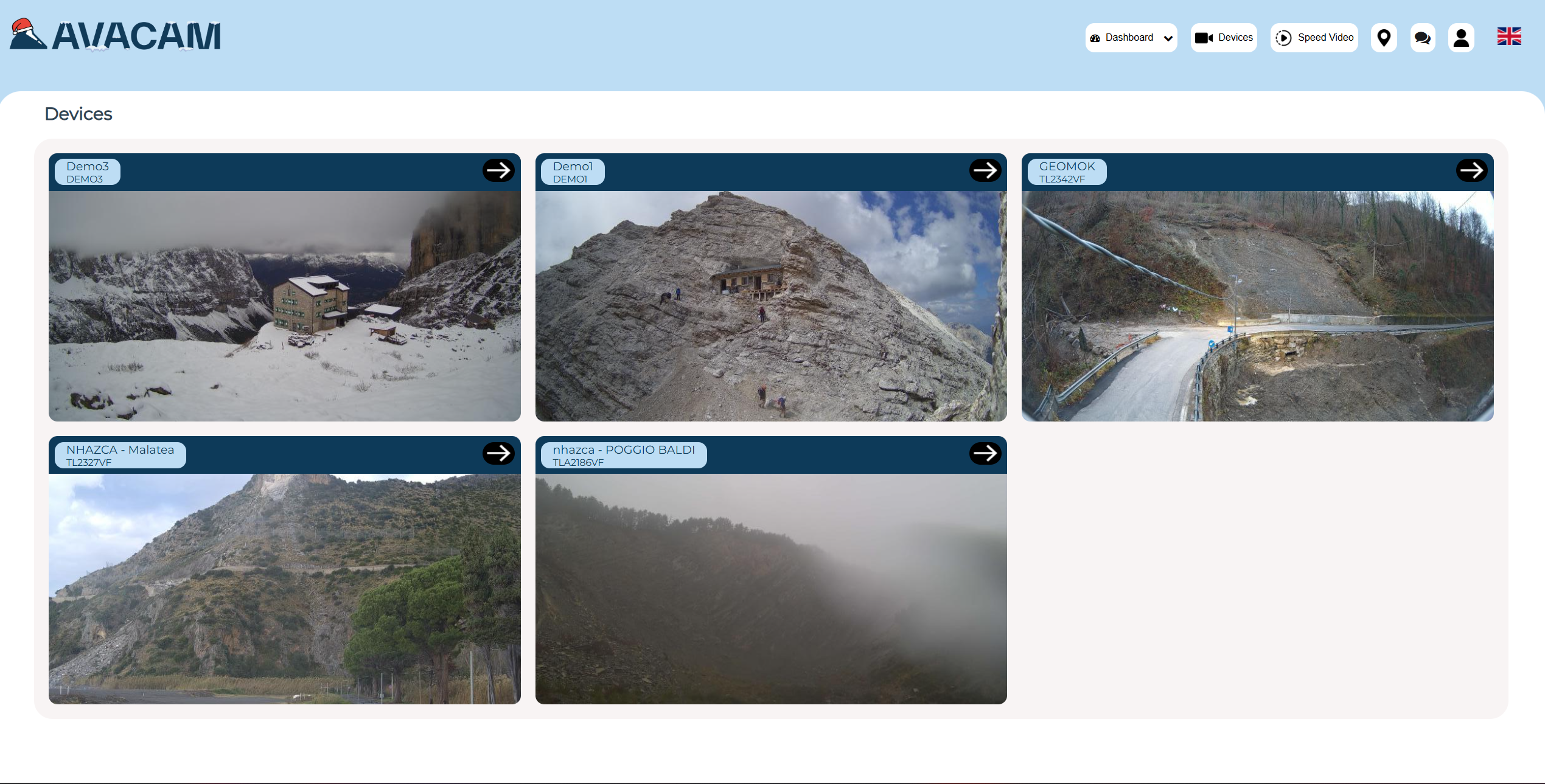

View photos
Access a comprehensive photo gallery that displays time‑lapse images and snapshots collected from your monitoring sites. Our platform organizes visual data chronologically, making it easy to track changes over time and spot early signs of movement or risk escalation. The View Photos section provides high‑resolution imagery, zoom tools, and filtering options so you can analyze events and share observations with your team effortlessly.
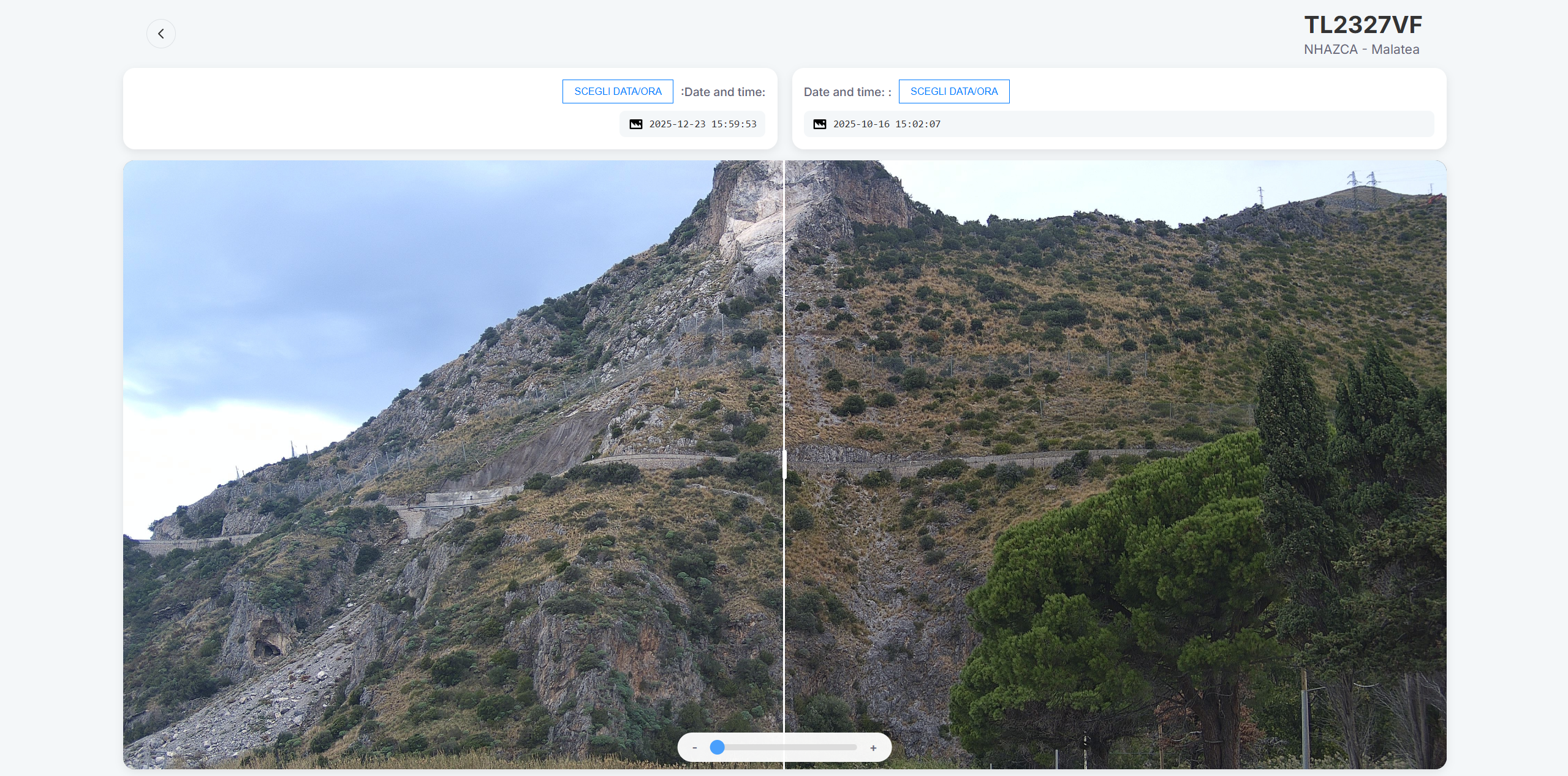
function: split view
Our Split Function lets you compare two images simultaneously to spot differences and changes over time. This feature is essential for visual analysis, letting users precisely evaluate shifts in terrain, structures, or environmental conditions. Simply select two timestamps and view them side‑by‑side in a split view layout—ideal for presentations, reporting, or field verification.
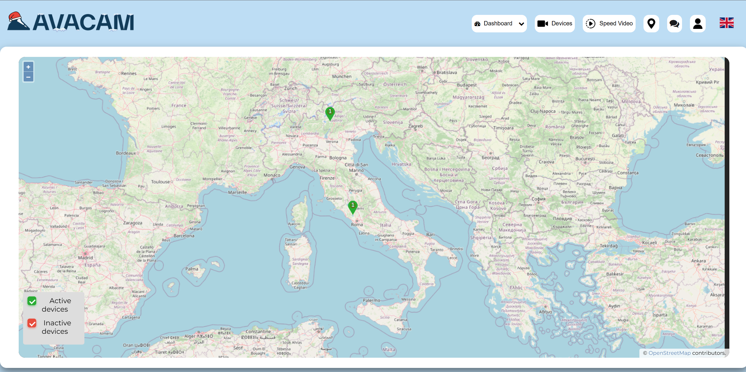
map
The Map section offers a detailed geographic interface showing all deployed sensors and camera locations. Zoom, pan, and explore your monitoring network with real‑time overlays that display site status, movement indicators, and alert zones.
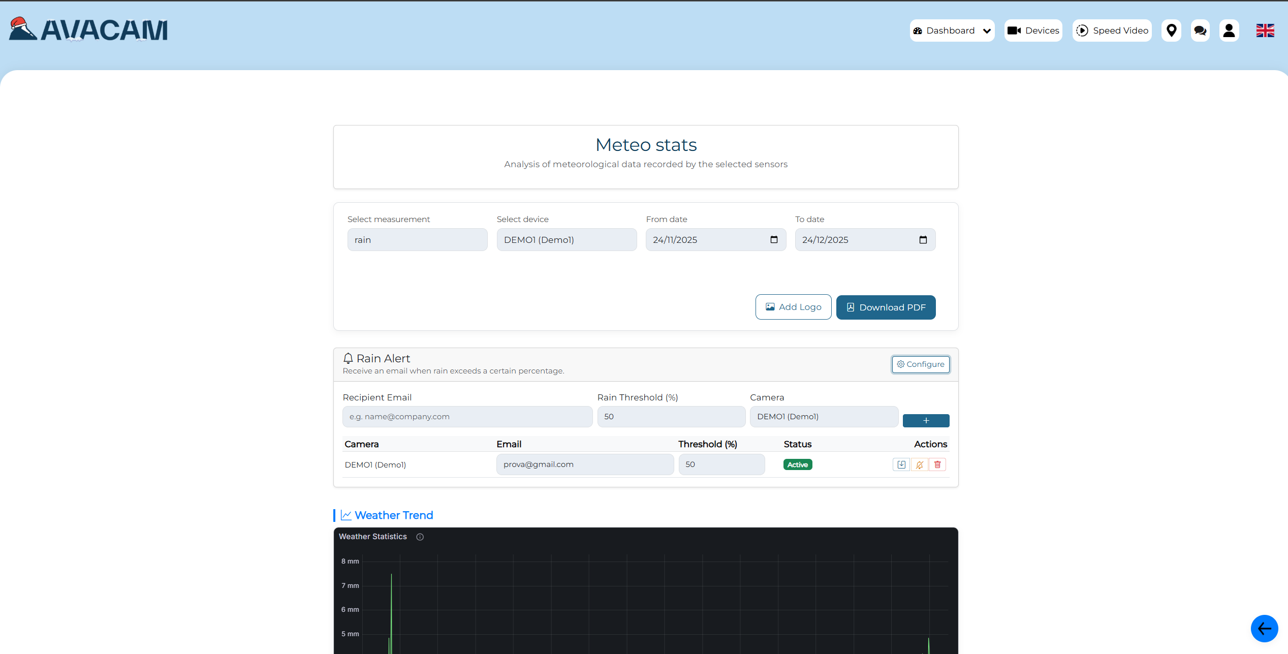
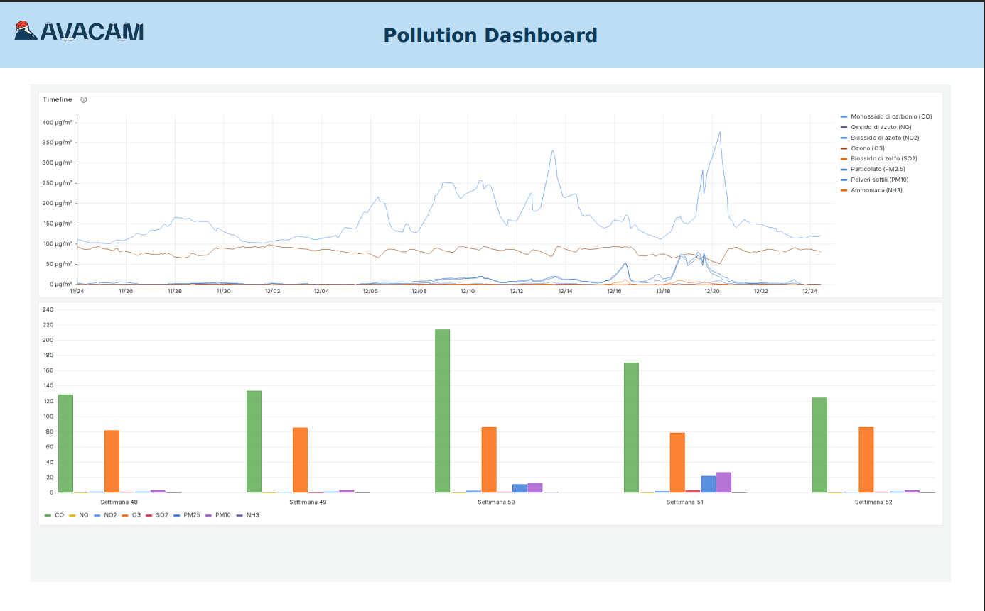
our reports
Our Reports section provides in‑depth information and analysis generated from your collected data. Choose specific time ranges, sensor types, or monitoring sites to generate tailored reports that summarize key findings, trends, and events. Each report helps stakeholders understand complex environmental data through easy‑to‑read charts, graphs, and commentary. These insights are ideal for internal reviews, risk assessments, or regulatory compliance.
pdF REPORT
Export your monitoring insights into professional PDF reports ready for distribution. Each PDF includes summaries, visuals, graphs, and site details formatted for clarity and impact. Whether you need documentation for internal teams, regulatory bodies, or public stakeholders, PDF reports make it simple to communicate findings with context and credibility.